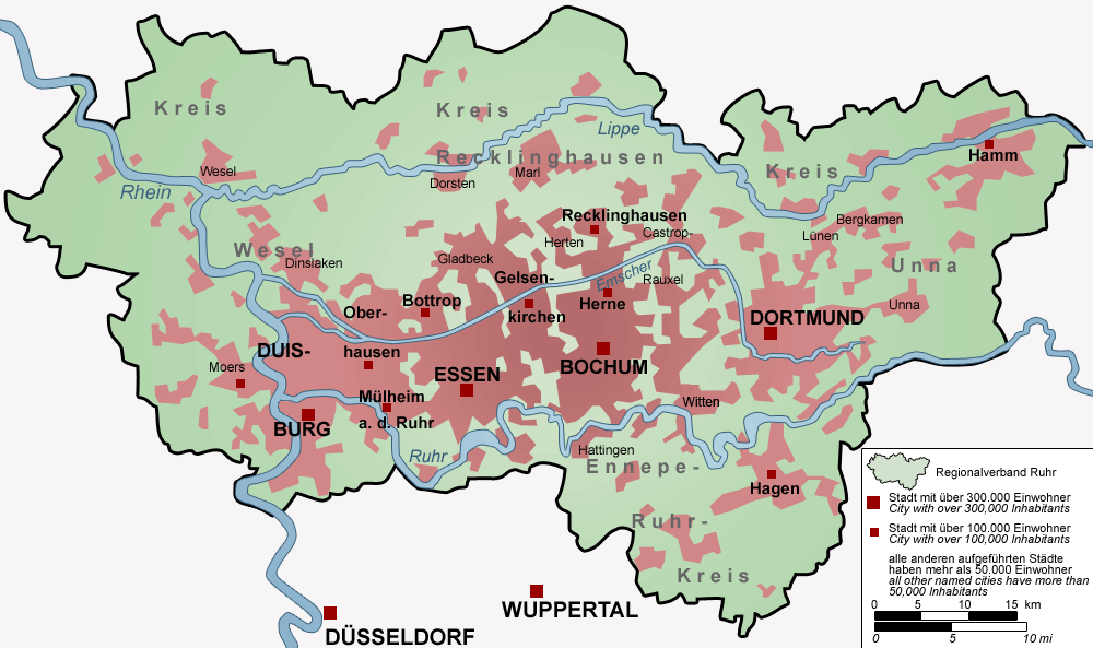
A map of the Ruhr. Attribution: Threedots (Daniel Ullrich).
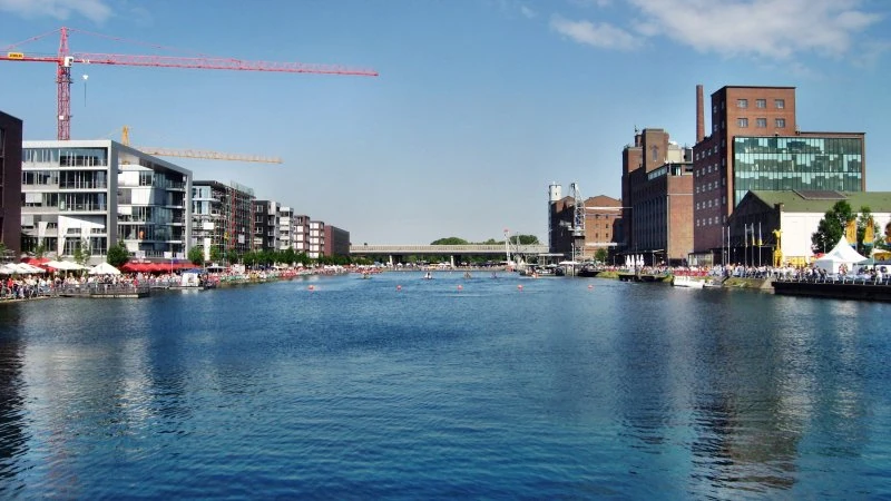
View of the redeveloped Duisburg Inner Harbour in 2010.

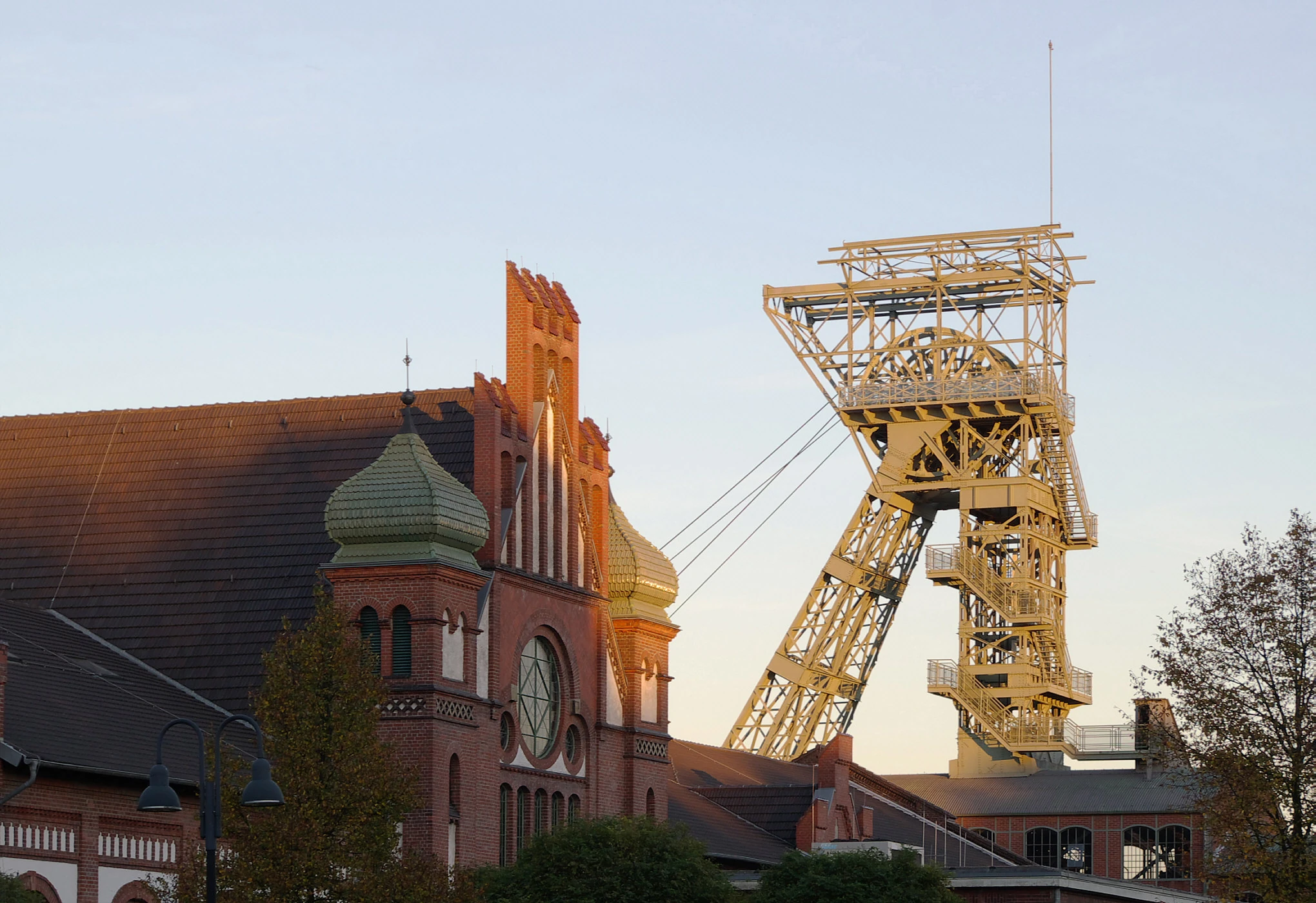
The Zeche Zollern in Dortmund.
Background and history
The Lower Rhine Basin and the the Ruhr make a good example of such history, geography and human factors which lay behind such incidents.
The Rhine (Latin: Rhenus, Romansh: Rein, German: Rhein, French: le Rhin, Italian: Reno, Dutch: Rijn) is a European river that begins in the Swiss canton of Graubünden in the southeastern Swiss Alps, forms part of the Swiss-Liechtenstein, Swiss-Austrian, Swiss-German and then the Franco-German border, then flows through the German Rhineland and the Netherlands and eventually empties into the North Sea.
The largest city on the Rhine is Cologne, Germany, with a population of more than 1,050,000 people. It is the second-longest river in Central and Western Europe (after the Danube), at about 1,230 km (760 mi),[note 2][note 1]with an average discharge of about 2,900 m3/s (100,000 cu ft/s).
The Rhine and the Danube formed most of the northern inland frontier of the Roman Empire and, since those days, the Rhine has been a vital and navigable waterway carrying trade and goods deep inland. Its importance as a waterway in the Holy Roman Empire is supported by the many castles and fortifications built along it. In the modern era, it has become a symbol of German nationalism.
In Bonn, where the Sieg flows into the Rhine, the Rhine enters the North German Plain and turns into the Lower Rhine. The Lower Rhine falls from 50 m to 12 m. The main tributaries on this stretch are the Ruhr and the Lippe. Like the Upper Rhine, the Lower Rhine used to meander until engineering created a solid river bed. Because the levees are some distance from the river, at high tide the Lower Rhine has more room for widening than the Upper Rhine.
The Lower Rhine flows through North Rhine-Westphalia. Its banks are usually heavily populated and industrialized, in particular the agglomerations Cologne, Düsseldorf and Ruhr area. Here the Rhine flows through the largest conurbation in Germany, the Rhine-Ruhr region. One of the most important cities in this region is Duisburg with the largest river port in Europe (Duisport). The region downstream of Duisburg is more agricultural. In Wesel, 30 km downstream of Duisburg, is located the western end of the second east-west shipping route, the Wesel-Datteln Canal, which runs parallel to the Lippe. Between Emmerich and Cleves the Emmerich Rhine Bridge, the longest suspension bridge in Germany, crosses the 400-metre-wide (1,300 ft) river. Near Krefeld, the river crosses the Uerdingen line, the line which separates the areas where Low German and High Germanare spoken.
Until the early 1980s, industry was a major source of water pollution. Although many plants and factories can be found along the Rhine up into Switzerland, it is along the Lower Rhine that the bulk of them are concentrated, as the river passes the major cities of Cologne, Düsseldorf and Duisburg. Duisburg is the home of Europe's largest inland port and functions as a hub to the sea ports of Rotterdam, Antwerp and Amsterdam. The Ruhr, which joins the Rhine in Duisburg, is nowadays a clean river, thanks to a combination of stricter environmental controls, a transition from heavy industry to light industry and cleanup measures, such as the reforestation of Slag and brownfields. The Ruhr currently provides the region with drinking water. It contributes 70 m3/s (2,500 cu ft/s) to the Rhine. Other rivers in the Ruhr Area, above all, the Emscher, still carry a considerable degree of pollution.
The urban landscape of the Ruhr extends from the Lower Rhine Basin east to the Westphalian Plain and south to the hills of the Rhenish Massif. Through the centre of the Ruhr runs a segment of the loess belt that extends across Germany from west to east. Historically, this loess belt has underlain some of Germany's richest agricultural regions.
Geologically, the region is defined by coal-bearing layers from the upper Carboniferous period. The coal seams reach the surface in a strip along the river Ruhr and dip downward from the river to the north. Beneath the Lippe, the coal seams lie at a depth of 600 to 800 metres (2,000 to 2,600 feet). The thickness of the coal layers ranges from one to three metres (three to ten feet). This geological feature played a decisive role in the development of coal mining in the Ruhr.
According to the Regionalverband Ruhr (RVR, Ruhr Regional Association), 37.6% of the region's area is built up. A total of 40.7% of the region's land remains in agricultural use. Forests account for 17.6%, and bodies of water and other types of land use occupy the rest. The inclusion of four mainly rural districts in the otherwise mainly industrial Ruhr helps to explain the large proportion of agricultural and forested land. In addition, the city boroughs of the Ruhr region have outlying districts with a rural character.
Seen on a map, the Ruhr could be considered a single city, since—at least in the north-south dimension—there are no visible breaks between the individual city boroughs. Thus the Ruhr is described as a polycentric urban area, which shares a similar history of urban and economic development.
Because of its history, the Ruhr is structured differently from monocentric urban regions such as Berlin and London, which developed through the rapid merger of smaller towns and villages with a growing central city. Instead, the individual city boroughs and urban districts of the Ruhr grew independently of one another during the Industrial Revolution. The population density of the central Ruhr is about 2,100 inhabitants per square kilometre (about 5,400 per square mile)—low compared to other German cities.
Between the constituent urban areas are relatively open suburbs and some open land with agricultural fields. In some places, the borders between cities in the central Ruhr are unrecognizable due to continuous development across them.
Replanting of brownfield land has created new parks and recreation areas. The Emscher Landschaftspark (Emscher Landscape Park) lies along the river Emscher, formerly virtually an open sewer, parts of which have undergone natural restoration. This park connects strips of parkland running from north to south, which were developed through regional planning in the 1920s, to form a green belt between the Ruhr cities from east to west.
During the Middle Ages, much of the region that was later called the Ruhrgebiet was situated in the County of Mark, the Duchies of Cleves and Berg and the territories of the bishop of Münster and the archbishop of Cologne. The region included some villages and castles, and was mainly agrarian: its loess soil made it one of the richer parts of western Germany. The free imperial city of Dortmund was the trading and cultural centre, lying on the Hellweg, an important east-west trading route, that also brought prosperity to the town of Duisburg. Both towns were members of the Hanseatic League.
The development of the region into an urbanized industrial area started in the late 18th century with the early industrialisation in the nearby Wupper Valley in the Bergisches Land. By around 1820, hundreds of water-powered mills were producing textiles, lumber, shingles and iron in automated processes here. And in even more workshops in the hills, highly skilled workers manufactured knives, tools, weapons and harnesses, using water, coal and charcoal. History has no established name for this phase of the industrial revolution, but one could call it the early water-powered industrial revolution.
As the machines became bigger and moved from water power to steam power, locally mined coal and charcoal became expensive and there was not enough of it. The Bergische industry ordered more and more coal from the new coal mining area along the Ruhr. Impressive and expensive railways were constructed through the hilly Wupper region, to bring coal, and later steel, in from the Ruhr, and for outward transport of finished products.
By 1850, there were almost 300 coal mines in operation in the Ruhr area, in and around the central cities of Duisburg, Essen, Bochum and Dortmund. The coal was exported or processed in coking ovens into coke, used in blast furnaces, producing iron and steel. In this period the name Ruhrgebiet became common. Before the coal deposits along the Ruhr were exhausted, the mining industry moved northward to the Emscher and finally to the Lippe, drilling ever deeper mines as it went. Locks built at Mülheim on the Ruhr led to the expansion of Mülheim as a port. With the construction of the Cologne-Minden railway in the late 19th century, several iron works were built within the borders of the present-day city of Oberhausen.
The population climbed rapidly. Towns with only 2000 to 5000 people in the early 19th century grew in the following 100 years to over 100,000. Skilled mineworkers were recruited from other regions to the Ruhr's mines and steel mills and unskilled people started to move in. From 1860 onwards there was large-scale migration from Silesia, Pomerania, East Prussia and Posen to the Ruhr. Many of them were Polish speakers and they were treated as second class citizens. In 1899 this led to a revolt in Herne of young Polish workers, who later established a Workers' Union. Skilled workers in the mines were often housed in "miners' colonies", built by the mining firms. By the end of the Prussian Kingdom in 1870, over 3 million people lived in the Ruhrgebiet and the new coal-mining district had become the largest industrial region of Europe.
During World War I the Ruhrgebiet functioned as Germany's central weapon factory. At a big Essen company, F. Krupp A.G., the number of employees rose from 40,000 to 120,000 or more, in four years. They were partly women, partly forced labourers.
The January Uprising in 1919 became popular among the working class in the Ruhr, and the region quickly turned communist. But when the uprising was snuffed out by the Freikorp, everything seemed to be fine until the Kapp government then fought the Weimar government, until the Weimar government came out victorious, but during that time, a return to an autocratic state was seen as the only way forward. But large parts of the working class went out on strike, but in the Ruhr, striking workers successfully managed to take government buildings, a shock to the rest of Germany. An armed revolt was then instigated, and the Red Guard then installed a branch in the Ruhr. Then the people there declared the Ruhr an independent, socialist republic, but the Freikorp came back into the scene and put down the movement.
In March 1921, French and Belgian troops occupied Duisburg, which under the Treaty of Versailles formed part of the demilitarized Rhineland. In January 1923 the whole Ruhrgebiet was occupied as a reprisal after Germany failed to fulfill World War I reparation payments as agreed in the Versailles Treaty. The German government responded with "passive resistance", letting workers and civil servants refuse orders and instructions by the occupation forces. Production and transport came to a standstill and the financial consequences contributed to German hyperinflation and ruined public finances in Germany and France, as well as several other countries. Passive resistance was called off in late 1923, allowing Germany to implement a currency reform and to negotiate the Dawes Plan, which led to the withdrawal of the French and Belgian troops from the Ruhr in 1925. However, the occupation of the Ruhr caused several direct and indirect consequences on the German economy and government. Due to the lack of production caused by foreign occupation, the German economy lacked the domestic abilities to pay war reparations without intentionally causing inflation. Moreover, the government became increasingly unpopular due to its "passive resistance" to German production. The halt in domestic production made war reparations impossible to pay.
On 7 March 1936, Adolf Hitler took a massive gamble by sending 30,000 troops into the Rhineland. As Hitler and other Nazis admitted, the French army alone could have destroyed the Wehrmacht. The French passed the problem to the British, who found that the Germans had the right to "enter their own backyard", and no action was taken. In the League of Nations, the Soviet delegate Maxim Litvinov was the only one who proposed economic sanctions against Germany. According to historian Samuel Mitcham, the Rhineland crisis was the last chance for the Allies to defeat Hitler while the odds were overwhelmingly on their side. All restraint on German rearmament could now be removed, and was. France's eastern allies (the Soviet Union, Poland, Czechoslovakia, Romania and Yugoslavia) concluded that since the French refused to defend their own border, they certainly would not stand up for their allies in the East. Hitler could now continue eroding the alliance system that France had built since 1919. On October 16, 1936, Belgium repudiated the 1921 alliance with France and declared its absolute neutrality. In October 1937, Belgium signed a non-aggression pact with Germany.
During World War II, the bombing of the Ruhr in 1940–1944 caused a loss of 30% of plant and equipment (compared to 15–20% for German industry as a whole).A second battle of the Ruhr (6/7 October 1944 – end of 1944) began with an attack on Dortmund. The devastating bombing raids of Dortmund on 12 March 1945 with 1,108 aircraft – 748 Lancasters, 292 Halifaxes, 68 Mosquitos – was a record to a single target in the whole of World War II. More than 4,800 tons of bombs were dropped through the city centre and the south of the city.
In addition to the strategic bombing of the Ruhr, in April 1945, the Allies trapped several hundred thousand Wehrmachttroops in the Ruhr Pocket.
After the war, the Level of Industry plans for Germany abolished all German munitions factories and civilian industries that could support them and severely restricted civilian industries of military potential. The French Monnet Plan pushed for an internationalization of the area, and the subsequent Ruhr Agreement was imposed as a condition for the establishment of the Federal Republic of Germany.
During the Cold War, the Western allies anticipated that any Red Army thrust into Western Europe would begin in the Fulda Gap and have the Ruhr as a primary target. Increased German control of the area was limited by the pooling of German coal and steel into the multinational European Coal and Steel Community in 1951. The nearby Saar (protectorate) region, containing much of Germany's remaining coal deposits, was handed over to economic administration by France as a protectorate in 1947 and did not politically return to Germany until January 1957, with economic reintegration occurring two years later. Parallel to the question of political control of the Ruhr, the Allies tried to decrease German industrial potential by limitations on production and dismantling of factories and steel plants, predominantly in the Ruhr. By 1950, after the virtual completion of the by-then much watered-down "level of industry" plans, equipment had been removed from 706 manufacturing plants in the west, and steel production capacity had been reduced by 6.7 million tons. Dismantling finally ended in 1951. In all, less than 5% of the industrial base was dismantled.
The Ruhr was at the center of the German economic miracle Wirtschaftswunder of the 1950s and 1960s, as very rapid economic growth (9% a year) created a heavy demand for coal and steel.
After 1973, Germany was hard hit by a worldwide economic crisis, soaring oil prices, and increasing unemployment, which jumped from 300,000 in 1973 to 1.1 million in 1975. The Ruhr region was hardest hit, as the easy-to-reach coal mines became exhausted, and German coal was no longer competitive. Likewise the Ruhr steel industry went into sharp decline, as its prices were undercut by lower-cost suppliers such as Japan. The welfare system provided a safety net for the large number of unemployed workers, and many factories reduced their labor force and began to concentrate on high-profit specialty items.
As demand for coal decreased after 1958, the area went through phases of structural crisis (see steel crisis) and industrial diversification, first developing traditional heavy industry, then moving into service industries and high technology. The air and water pollution of the area are largely a thing of the past although some issues take a long time to solve. In 2005, Essen was the official candidate for nomination as European Capital of Culture for 2010.
The local dialect of German is commonly called Ruhrdeutsch or Ruhrpottdeutsch, although there is really no uniform dialect that justifies designation as a single dialect. It is rather a working class sociolect with influences from the various dialects found in the area and changing even with the professions of the workers. A major common influence stems from the coal mining tradition of the area. For example, quite a few locals prefer to call the Ruhr either "Pott", which is a derivate of "Pütt" (pitmen's term for mine; cp. the English "pit"), or "Revier".
During the 19th century the Ruhr attracted up to 500,000 ethnic Poles, Masurians and Silesians from East Prussia and Silesia in a migration known as Ostflucht (flight from the east). By 1925, the Ruhrgebiet had around 3.8 million inhabitants. Most of the new inhabitants came from Eastern Europe, but immigrants also came from France, Ireland, and the United Kingdom. It has been claimed that immigrants came to the Ruhr from over 140 different nations. Almost all their descendants today speak German as a mother tongue, and for various reasons they do not identify with their Polish roots and traditions, often only their Polish family names remaining as a sign of their past.
Incidents
General history in the Rhine and the Ruhr
Until the early 1980s, industry was a major source of water pollution. Although many plants and factories can be found along the Rhine up into Switzerland, it is along the Lower Rhine that the bulk of them are concentrated, as the river passes the major cities of Cologne, Düsseldorf and Duisburg. Duisburg is the home of Europe's largest inland port and functions as a hub to the sea ports of Rotterdam, Antwerp and Amsterdam. The Ruhr, which joins the Rhine in Duisburg, is nowadays a clean river, thanks to a combination of stricter environmental controls, a transition from heavy industry to light industry and cleanup measures, such as the reforestation of slag and brownfields. The Ruhr currently provides the region with drinking water. It contributes 70 m3/s (2,500 cu ft/s) to the Rhine. Other rivers in the Ruhr Area, above all, the Emscher, still carry a considerable degree of pollution.
The River Rhine was so badly polluted because of the factories around it, which caused a leakage, and was nicknamed "the sewer of Europe".
The Rhine was so seriously polluted with both chemicals and sewage from the 1950s to the 1970s that it's fish died and it was declared dangerous to swim in.
Initial cleanup plans began in the early 1970s and ended with much success in the early 1980s
In 1986 the river was severely polluted by a Swiss chemical factory fire. Within 10 days the pollution had travelled the length of the Rhine and into the North Sea.
There was a public outcry, resulting in the Rhine Action Programme of 1987. It is sometimes known as "Salmon 2000" because its stated target on fish levels was to see the return of salmon to the Rhine by the year 2000, which some did indeed do.There was a 50% reduction in pollution by nitrates and phosphorus, with some other, more toxic types, being cut by 80 to 100%.
The Rhine was beginning to recover in the late 1990s due to new German and EU environmental laws and had recovered by the mid 2000s.
The pollution from the river Rhine is now currently coming from: Factories, waste from humans, poisonus residue from mines, animal waste and dumped garbage. It is all deposited into the river that causes it to pollute, and thus destroys wildlife (it kills both killes fish and salmon).
Rhine had highest level of microplastics pollution measured in any river in 2015
Multi-coloured Rhine pollution affair
Oil, hydraulic fluid, pesticides, some mercury and other highly poisonous agricultural chemicals were being dumped too often in the German stretch of the river turning it multicoloured or ssometimes red in the early to mid 1980s.
1986 Rhine Chemical Spill\Red Rhine pollution affair
In 1986 the river was severely polluted by a Swiss chemical factory fire. Within 10 days the pollution had travelled the length of the Rhine and into the North Sea.
The catastrophic morning fire at a chemicals factory owned by Sandoz, one of Switzerland's largest chemical firms. The plant was near Basel, Switzerland, on land near to the upper reaches of the River Rhine.
About 30 tons of pesticides, some mercury and other highly poisonous agricultural chemicals poured in to the river as firefighters tryed to tackle the fire and turned the water red.
An estimated half a million fish were killed, and some species were wiped out entirely.
Within 10 days the pollution had travelled the length of the Rhine and into the North Sea.
The West German Chemicals Industry Association carried out an internal report on the disaster. Bothe West Germany and the Netherlands were concerned by the incident.
There was a public outcry, resulting in the Rhine Action Programme of 1987. It is sometimes known as "Salmon 2000" because its stated target on fish levels was to see the return of salmon to the Rhine by the year 2000, which some did indeed do.There was a 50% reduction in pollution by nitrates and phosphorus, with some other, more toxic types, being cut by 80 to 100%.
Red Ruhr pollution affair
Oil, hydraulic fluid, pesticides, some mercury and other highly poisonous agricultural chemicals were being dumped too often in the German stretch of the river turning it red or some times multicolored in the early to mid 1980s.
Iron oxide in the Spree River
.
Elk River
.
Oka River
.
Elbe River
.
Sewage in the Roden River
.
the Heiligenstadt electroplating plant
.
Salinity of the River Weser
The 1972 rise in the salinity of the River Weser broke athe 1972 FRG-GDR treaty on not poluting the border zone between the nations.
Also see
- Environmental disasters
- The Four Big Pollution Diseases of Japan
- Air quality issues in Nowa Huta, Cluj, Ploiești, Bitterfeld and Teltow
Sources
- The UK tabloid press in the mid 1980s.
- https://en.wikipedia.org/wiki/Ruhr
- http://www.bbc.co.uk/schools/gcsebitesize/geography/economic_change/industry_medcs_rev1.shtml
- https://pixabay.com/en/ruhr-area-air-pollution-chimney-970168/
- https://www.revolvy.com/main/index.php?s=Ruhr%20Area
- https://en.wikipedia.org/wiki/Ruhr
- https://en.wikipedia.org/wiki/Ruhr_(river)
- https://www.revolvy.com/main/index.php?s=Ruhr
- https://www.revolvy.com/main/index.php?s=Ruhr
- https://pixabay.com/en/ruhr-area-air-pollution-chimney-970168/
- http://redgreenandblue.org/2018/04/18/californias-love-affair-big-oil-marine-protection-cap-trade/
- https://www.telegraph.co.uk/finance/economics/11880921/Made-in-Germany-lies-in-the-gutter-after-Volkswagen-caught-cheating.html
- https://en.wikipedia.org/wiki/Ruhr
- https://www.cvce.eu
- http://www.worldjournals.org/articles/Ruhr
- https://www.jstor.org/stable/623205?seq=1#page_scan_tab_contents
- https://en.wikipedia.org/wiki/Ruhr#CITEREFLevine1992
- https://www.backtonormandy.org/component/mtree/air-force-operations/airplanes-in-actions/lancaster/16345-raf-bomber-command-748-lancasters-carried-out-a-large-attack-on-dorthmund-on-1112th-of-march-1945.html
- http://Fen.kulturhauptstadt-europas.de/
- https://aquapedia.waterdiplomacy.org/wiki/index.php?title=Water_Quality_and_Pollution_Control_in_the_Rhine_River_Basin
- http://www.thewaterpage.com/rhine_main.htm
- http://www.answers.com/Q/What_causes_river_rhine_to_pollution
- https://www.unibas.ch/en/News-Events/News/Uni-Research/Microplastics-Rhine-One-of-the-Most-Polluted-Rivers-Worldwide.html
- http://news.bbc.co.uk/1/hi/world/europe/2116542.stm
- http://www.primaryhomeworkhelp.co.uk/rivers/rhine.htm
- https://phys.org/news/2015-12-rhine-highest-microplastics-pollution-river.html
- http://www.primaryhomeworkhelp.co.uk/rivers/rhine.htm
- http://news.bbc.co.uk/onthisday/hi/dates/stories/november/1/newsid_4679000/4679789.stm
- http://www.thewaterpage.com/rhine_main.htm
- http://www.answers.com/Q/Why_is_the_river_rhine_polluted
- https://www.sciencedirect.com/science/article/pii/S1749772813000146
- http://www.environment911.org/The_River_Rhine_-_Taking_River_Basin_Management_to_the_Next_Level
- https://www.bbc.co.uk/programmes/p00bqry6
- https://www.bbc.co.uk/programmes/p00bqrxl
- https://www.sciencedirect.com/science/article/pii/S0378777X77800565
- http://www.spiegel.de/international/germany/environmentalists-combat-iron-pollution-in-east-german-spree-river-a-893886.html
- https://www.csmonitor.com/1984/1005/100538.html
- https://www.theguardian.com/world/2017/sep/02/germany-elbe-river-cultural-divide-east-west-federal-elections
- https://fee.org/articles/why-socialism-causes-pollution/
- http://america.aljazeera.com/articles/2014/1/13/coal-pollution-miningwestvirginiamassey.html
- http://thefederalist.com/2014/01/13/if-you-think-communism-is-bad-for-people-check-out-what-it-did-to-the-environment/
- http://www.dw.com/en/germanys-elbe-river-gets-radical-facelift/a-593323
- http://countrystudies.us/germany/81.htm
- http://news.bbc.co.uk/1/hi/world/europe/1371142.stm