Tag: rte-source |
No edit summary Tag: rte-source |
||
| Line 1: | Line 1: | ||
{{Under construction}} |
{{Under construction}} |
||
| + | [[File:Flag_of_Greenland.svg|thumb|The Flag of Greenland, called the Erfalasorput.]] |
||
==The location== |
==The location== |
||
Revision as of 04:06, 11 May 2015

The Flag of Greenland, called the Erfalasorput.
The location
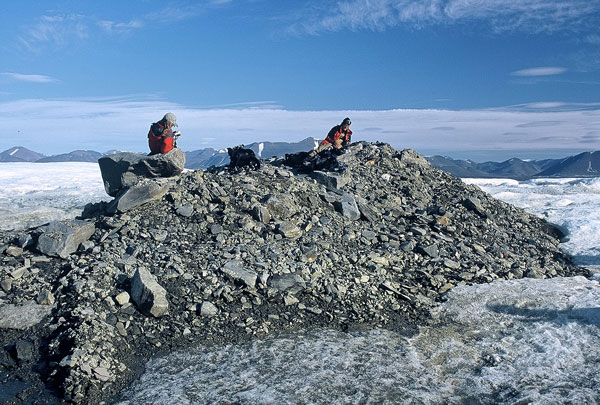
Oodaaq Island in 2003.
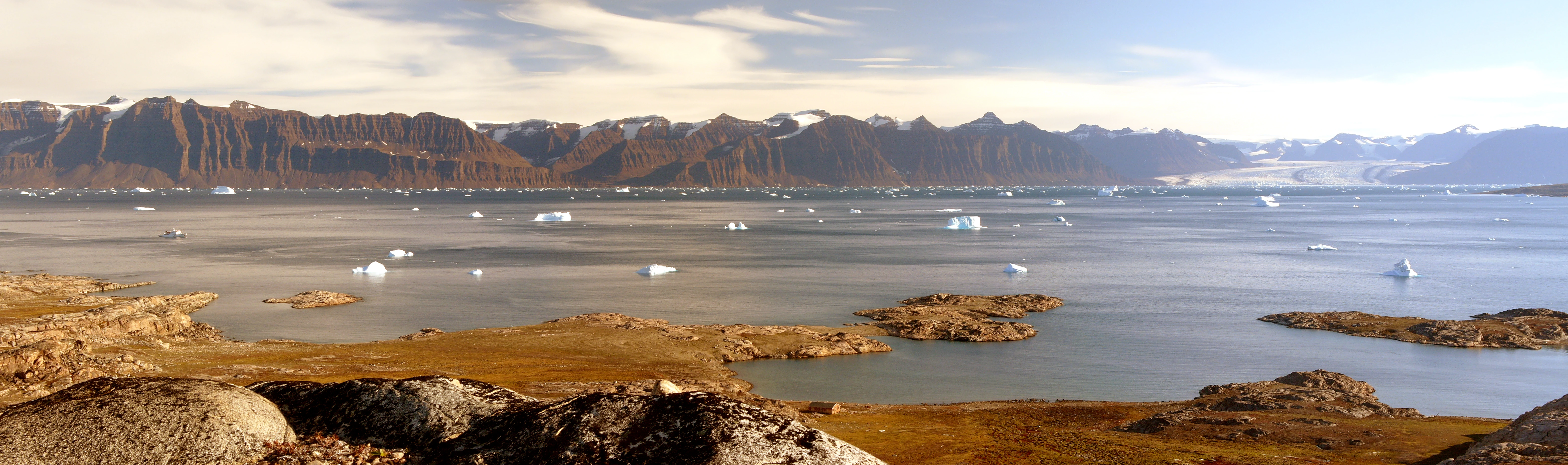
A view of Scoresby Sund in eastern Greenland, the longest fjord in the world.
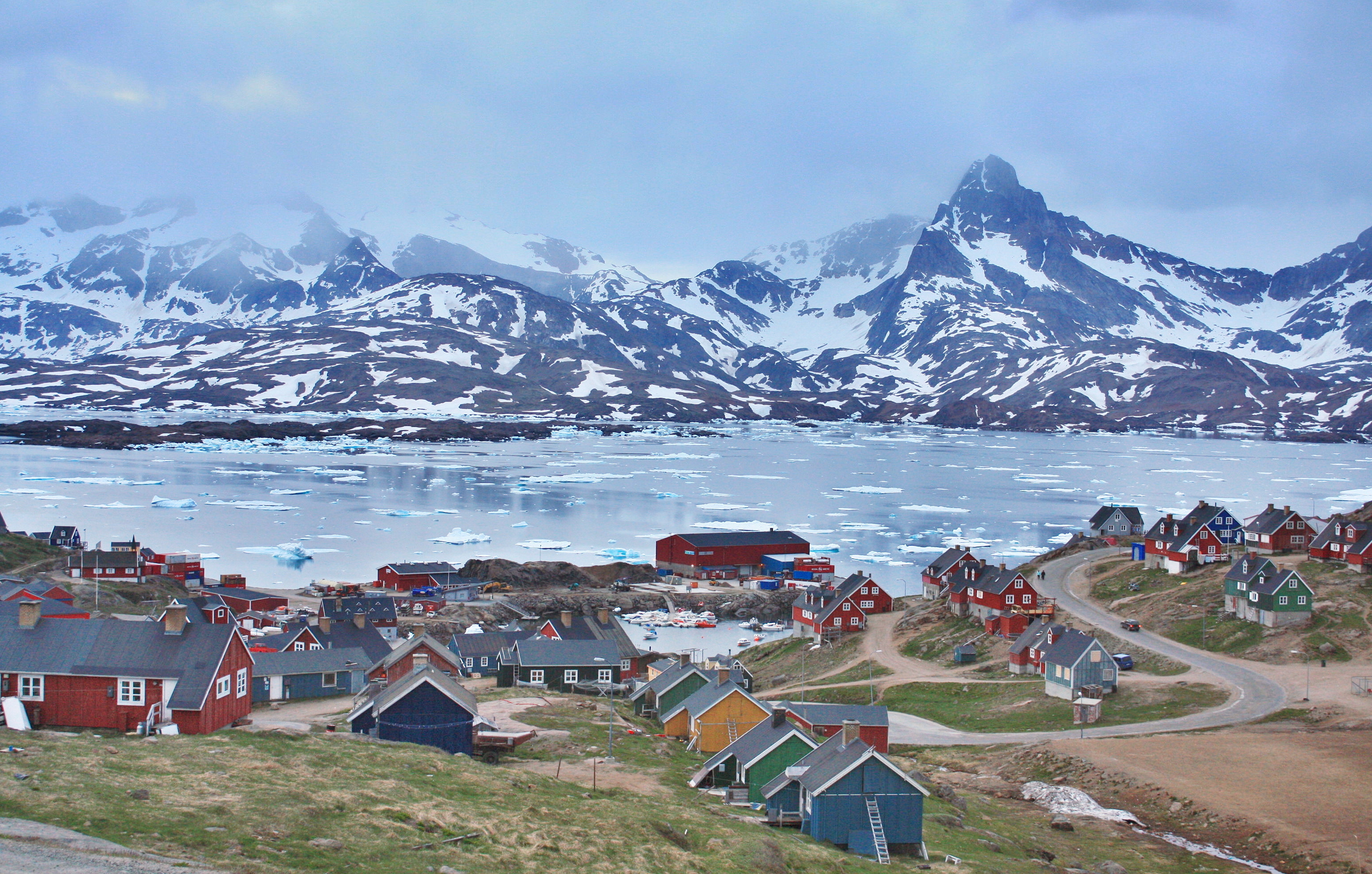
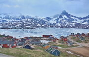
Night shot of Tasiilaq, eastern Greenland in the summer on 23 June 2009.
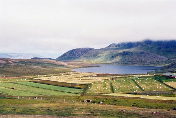
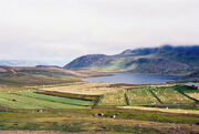
Southern Greenland lives up to its name as it is truly a green land. Agriculture thrives here with many farms and luxuriant vegetables, in contrast to a barren ice world that covers much of Greenland. Hay is harvested in Vatnahverfi, Garðar, in 2006.
Greenland is the world's largest non-continental island and lies between latitudes 59° and 83°N, and longitudes 11° and 74°W. The nearest countries to the Danish dependency are Canada, to the west across Baffin Bay, and Iceland, east of Greenland in the Atlantic Ocean. Greenland also contains the world's largest national park and it is the largest dependent territory by area in the world.
The total area of Greenland is 2,166,086 km2 (836,330 sq mi) (including other offshore minor islands), of which the Greenland ice sheet covers 1,755,637 km2 (677,855 sq mi) (81%) and has a volume of approximately 2,850,000 km3 (680,000 cu mi).[53] The highest point on Greenland is Gunnbjørn Fjeld at 3,700 m (12,139 ft). The majority of Greenland, however, is less than 1,500 m (4,921 ft) in physical elevation.
The climate and geology is mostly harsh, stony, windy and snowy, with the average daily temperature of city of Nuuk varying over the seasons from −8 to 7 °C (18 to 45 °F). Nuuk has a maritime-influenced polar climate (Köppen ET) with cold, snowy winters and cool summers. The climate in Kangerlussuaq is subarctic, bordering on polar continental, with the frigid area receiving very little rainfall during the year. Ivittuut holds the record for Greenland's highest recorded temperature of 30.1 °C (86.2 °F). The lowest recorded temperature was −28.9 °C (−20.0 °F). Tasiilaq has a tundra climate, with long, cold and snowy winters and short, cool drier summers. From time to time, Tasiilaq is affected by piteraqs. A piteraq is a cold katabatic wind which originates on the Greenlandic icecap and sweeps down the east coast. Narsarsuaq experiences boundary subarctic climate (Köppen: Dfc), which barely escapes being classified as polar climate, which is typical for the rest of Greenland. Narsarsuaq is fairly wet, with Atlantic storms pounding the town all year. The northern and central towns experiences the 24 hour Midnight sun/Arctic night event.
It was much warmer Borial climate and so more akin to southern Norway about 450,000 to 900,000 years earlier, by Viking days it was more like present day Iceland.
South-east coast of Greenland is the mildest part and was settled by Vikings and later Danish colonists, as well as being visited by Scottish waling vessels. Perhaps the most significant of Greenland's current inhabitants is a group of microbes that colonize cryoconite, a mixture of windblown soot and dust that contribute to rapid glacial melting. Cryoconite is powdery windblown dust made of a combination of small rock particles, soot, desert sands, dust, particles from volcanic eruptions and even in some cases power plant emissions.
After 986 CE, Greenland's west coast was settled by Icelanders and Norwegians, through a contingent of 14 longboats led by Erik the Red. The Norse Greenlanders (of Norwegian and Icelandic) origin finally submitted to Norwegian rule in the 13th century and was a part of the Kalmar Union from 1397. Brattahlíð and the other settlements did well until they dispersed sometime in the 15th century, perhaps at the onset of the Little Ice Age, which lasted until late Victorian times. At this time Icelandic Book of Settlements records famines during the winters in which "the old and helpless were killed and thrown over cliffs" in their colonies in Greenland. The last written records of the Norse Greenlanders are of a marriage in 1408 in the church of Hvalsey, then the Icelandic settlements also vanished during both the the 14th and 15th centuries, probably as a result of famine and increasing conflicts with the Inuit for resources.
In 1500, King Manuel I of Portugal sent Gaspar Corte-Real to Greenland in search of a Northwest Passage to Asia which, but they found the sea around Greenland to be frozen and headed south to re-discover Labrador and Newfoundland. Danish re-colonization began in the 1700s. From the late 18th century up to World War II, the Danish military and later some American researchers, would explore Greenland heavenly, by land, sea and air. American troops would arrive in 1941 and largly finish this off.
The USAAF/USAF biult several air bases in 1942 and 43 to secure it for the war time Allies.
Following WW2 fishing inspections and sea measuring began again and the first dedicated Greenland command was established, called the "Greenland Maritime Command", located at Nuuk. it changed name on August 1, 1951, to the "Island Command Greenland", while simultaneously moving from Nuuk to the Naval base at Kangilinnguit, the then only a Marine station, and staid there ever since.
Kangilinnguit was founded as "Green Valley" (Danish:Grønnedal) by the United States Navy during the Second World War to protect the highly strategic cryolite quarry in the former settlement of Ivittuut. Zink, nikel, bauxite, cryolite, tin, Iron and lead were also intermittently mined in small amounts for short periods of time elsewhere during the Cold War. The economy collapsed as the last zink mine. Narsarsuaq also contains some vertualy untapped gemstones. The mining of ruby deposits began in 2007. Other mineral prospects are improving as prices are increasing, including iron, uranium, aluminium, nickel, platinum, tungsten, titanium, and copper. Tourist, fish, stone, gravel, shellfish, crabs, lobsters and seals are the other industries.
The small town of Uummannaq is home to Greenlan's most northerly ferry terminal. It was funded in 1763 and has a population of ~1,200. The (Greenlandic: Ilulissat Kangerlua) southeast of Ilulissat was declared a UNESCO World Heritage Site in 2004.
The plan
A first strike over the North Pole could occur and would involve the bom,bing or missile strikes on the American bases.
Eventually the Soviet invasion of Greenland would occur anyway to prevent a defeted Icelandic or Danish goverment in exile forming, assuming the American air bases had not already secured the island for NATO.
NATO counter plan
NATO was reliant on the American bases to
The forces
Greenland had a population of only 52,000 and had no standing native army. It's unarmed armed coast guard being in charge of only search and rescue (SAR), fishery protection and anti-smuggling work. The devolved Danish Greenland Command organisation is authorised to request additional support from naval vessels, police cutters, the Royal Danish Air Force, civilian ships, aircraft from Air Greenland, and US or Icelandic SAR units based in Iceland if need be. Currently there are about 150 total civilian and military employees employed by the command, from both Danish and Greenlandic decent.
A Danish ski patrol, SAR helicopter service and a few light ships on patrol are also
The US run NATO bases were the only real armed forces the island has. US air bases were implanted on the island and
Bases
America had NATO air bases at Thule Air Base, Greenland, Narsarsuaq Airport and Kangerlussuaq Airport. Denmark had a patrol stationed at boat at the port of Gronnedal and Naval base at Kangilinnguit for fishery protection duties. These were the only meaningful armed forces on the island.
NATO also maintained a joint Greenlandic civil and US/UK/Danish run high power military radio mast near Nuuk from the early 1960s to the mid 1980s.
Also see
- Soviet invasion of Denmark
- Soviet invasion of Iceland
- Operation Northern Norway
- Operation Chrome Dome
- Exercise Northern Viking
Links
- http://en.wikipedia.org/wiki/Island_Command_Greenland
- http://en.wikipedia.org/wiki/Greenland
- http://en.wikipedia.org/wiki/Nuuk
- http://en.wikipedia.org/wiki/Cryoconite
- http://en.wikipedia.org/wiki/Kangerlussuaq
- http://en.wikipedia.org/wiki/Tasiilaq
- http://en.wikipedia.org/wiki/Piteraq
- http://en.wikipedia.org/wiki/Uummannaq
- http://en.wikipedia.org/wiki/Kangilinnguit
- http://en.wikipedia.org/wiki/Narsarsuaq
- http://en.wikipedia.org/wiki/Ilulissat_Icefjord
- http://en.wikipedia.org/wiki/Pituffik
- http://en.wikipedia.org/wiki/Ivittuut