The location
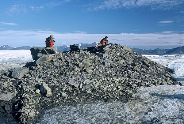
Oodaaq Island in 2003.
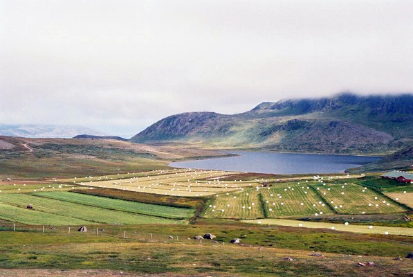
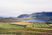
Southern Greenland lives up to its name as it is truly a green land. Agriculture thrives here with many farms and luxuriant vegetables, in contrast to a barren ice world that covers much of Greenland. Hay is harvested in Vatnahverfi, Garðar, in 2006.
Greenland is the world's largest non-continental island and lies between latitudes 59° and 83°N, and longitudes 11° and 74°W. The nearest countries to the Danish dependency are Canada, to the west across Baffin Bay, and Iceland, east of Greenland in the Atlantic Ocean. Greenland also contains the world's largest national park and it is the largest dependent territory by area in the world.
The total area of Greenland is 2,166,086 km2 (836,330 sq mi) (including other offshore minor islands), of which the Greenland ice sheet covers 1,755,637 km2 (677,855 sq mi) (81%) and has a volume of approximately 2,850,000 km3 (680,000 cu mi).[53] The highest point on Greenland is Gunnbjørn Fjeld at 3,700 m (12,139 ft). The majority of Greenland, however, is less than 1,500 m (4,921 ft) in physical elevation.
The climate is harsh, with the average daily temperature of Nuuk, Greenland varies over the seasons from −8 to 7 °C (18 to 45 °F).
It was much warmer and akin to southern Norway about 400,000 years earlier, by Viking days it was more like present day Iceland.
South-east coast of Greenland is the mildest part and was settled by Vikings and later Danish colonists, as well as being visited by Scottish waling vessels.
After 986 CE, Greenland's west coast was settled by Icelanders and Norwegians, through a contingent of 14 longboats led by Erik the Red. The Norse Greenlanders (of Norwegian and Icelandic) origin finally submitted to Norwegian rule in the 13th century and was a part of the Kalmar Union from 1397. Brattahlíð and the other settlements did well until they dispersed sometime in the 15th century, perhaps at the onset of the Little Ice Age, which lasted until late Victorian times. At this time Icelandic Book of Settlements records famines during the winters in which "the old and helpless were killed and thrown over cliffs" in their colonies in Greenland. The last written records of the Norse Greenlanders are of a marriage in 1408 in the church of Hvalsey, then the Icelandic settlements also vanished during both the the 14th and 15th centuries, probably as a result of famine and increasing conflicts with the Inuit for resources.
From the late 18th century up to World War II,the Danish military explored Greenland heavenly, by land, sea and air.
Following WW2 fishing inspections and sea measuring began again and the first dedicated Greenland command was established, called the "Greenland Maritime Command", located at Nuuk. it changed name on August 1, 1951, to the "Island Command Greenland", while simultaneously moving from Nuuk to the Naval base at Kangilinnguit, the then only a Marine station, and staid there ever since.
The USAAF/USAF
The plan
The forces
Greenland had a population of only 52,000 and had no standing native army. It's unarmed armed coast guard being in charge of only search and rescue (SAR), fishery protection and anti-smuggling work.
The NATO bases were the only real armed forces the island had.
Bases
America had NATO air bases at Thule Air Base, Greenland, Narsarsuaq Airport and Kangerlussuaq Airport. Denmark had a patrol stationed at boat at the port of Gronnedal. These were the only meaningful armed forces on the island.
NATO also maintained a joint Greendic civil and US/UK/Danish run high power military radio mast near Nuuk from the early 1960s to the mid 1980s.